
Sky-Ground Collaborative Inspection
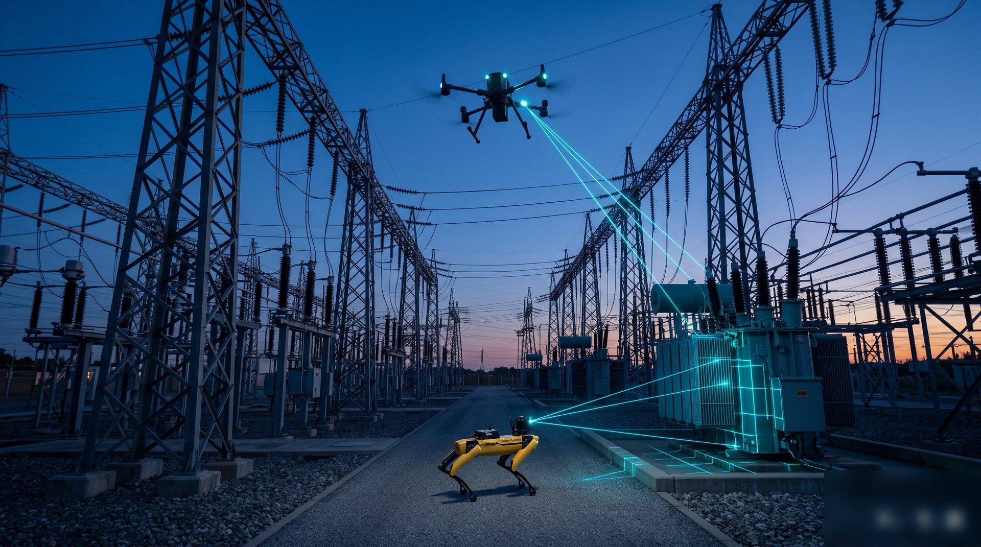
A stereo hardware inspection service combining aerial UAVs with ground robot dogs, widely used in chemical plants, substations, tunnels and pipe galleries. In the air, pilots fly UAVs for macroscopic high-altitude patrol; on the ground, operators remotely drive quadruped robots for close-range mobile inspection. The robot dog's four-legged mobility replaces humans in toxic, narrow and rugged hazardous areas, carrying visible-light or infrared cameras for on-site capture and hazard recording. With full hardware kits and professional teams plus rigorous inspection plans, unified dispatch via radio/video link realizes the standardized workflow of aerial wide-area coverage, ground close-range verification, backend human review and closed-loop hazard rectification — effectively eliminating inspection blind spots and greatly reducing high-risk manual work.
Intelligent Patrol Management Platform
The platform is the core of the whole inspection system. It processes and analyses robot-collected data in real time, compares with historical data and applies pattern recognition to evaluate equipment status and issue early warnings. It also unifies data management and storage for traceability, supporting multi-device access, cloud visualization, auto patrol, intelligent analysis, warning, linkage and decision-making.
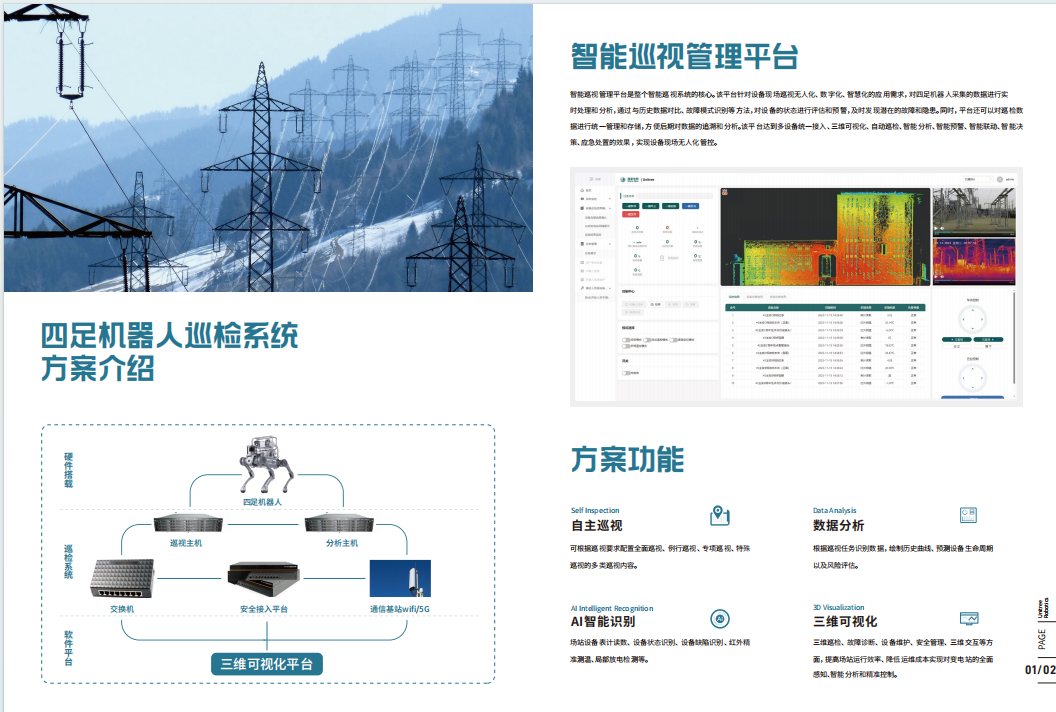
Solution Functions
Autonomous Patrol
Configure full, routine, special and ad-hoc patrol types per inspection demand.
Data Analysis
Draw historical curves from patrol data, predict equipment lifecycle and risk.
AI Recognition
Meter reading, status recognition, nameplate OCR, infrared thermometry and partial-discharge detection.
3D Visualization
3D modelling, fault diagnosis, maintenance and safety management to cut O&M cost.
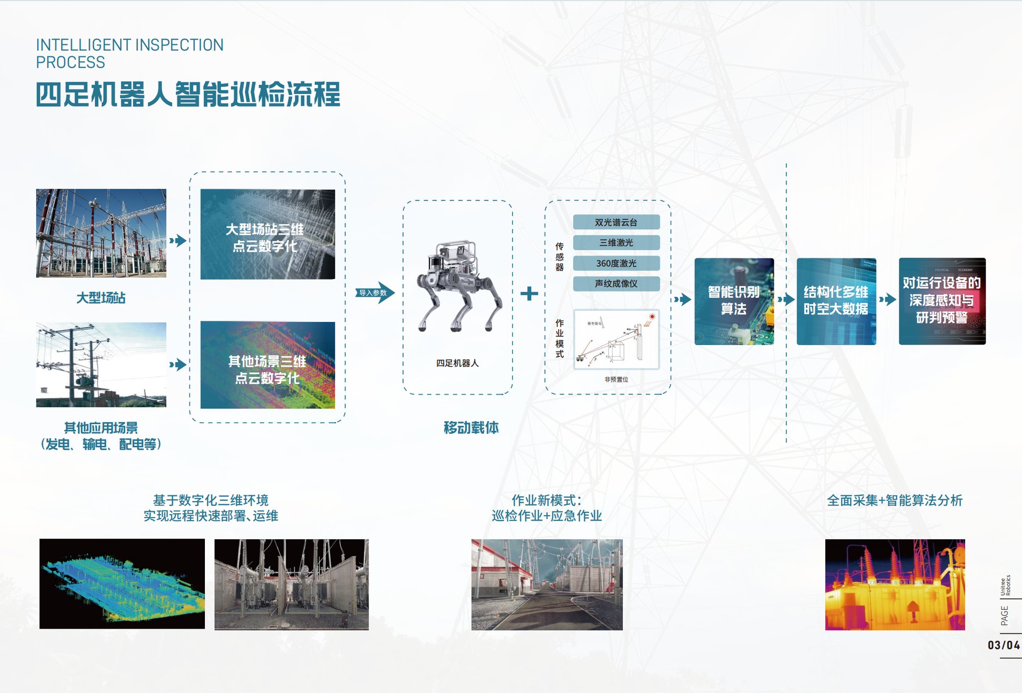
Intelligent Inspection Workflow
3D Site Digitization
Point-cloud digitization of large sites and generation/transmission/distribution scenes.
Mobile Carrier + Sensors
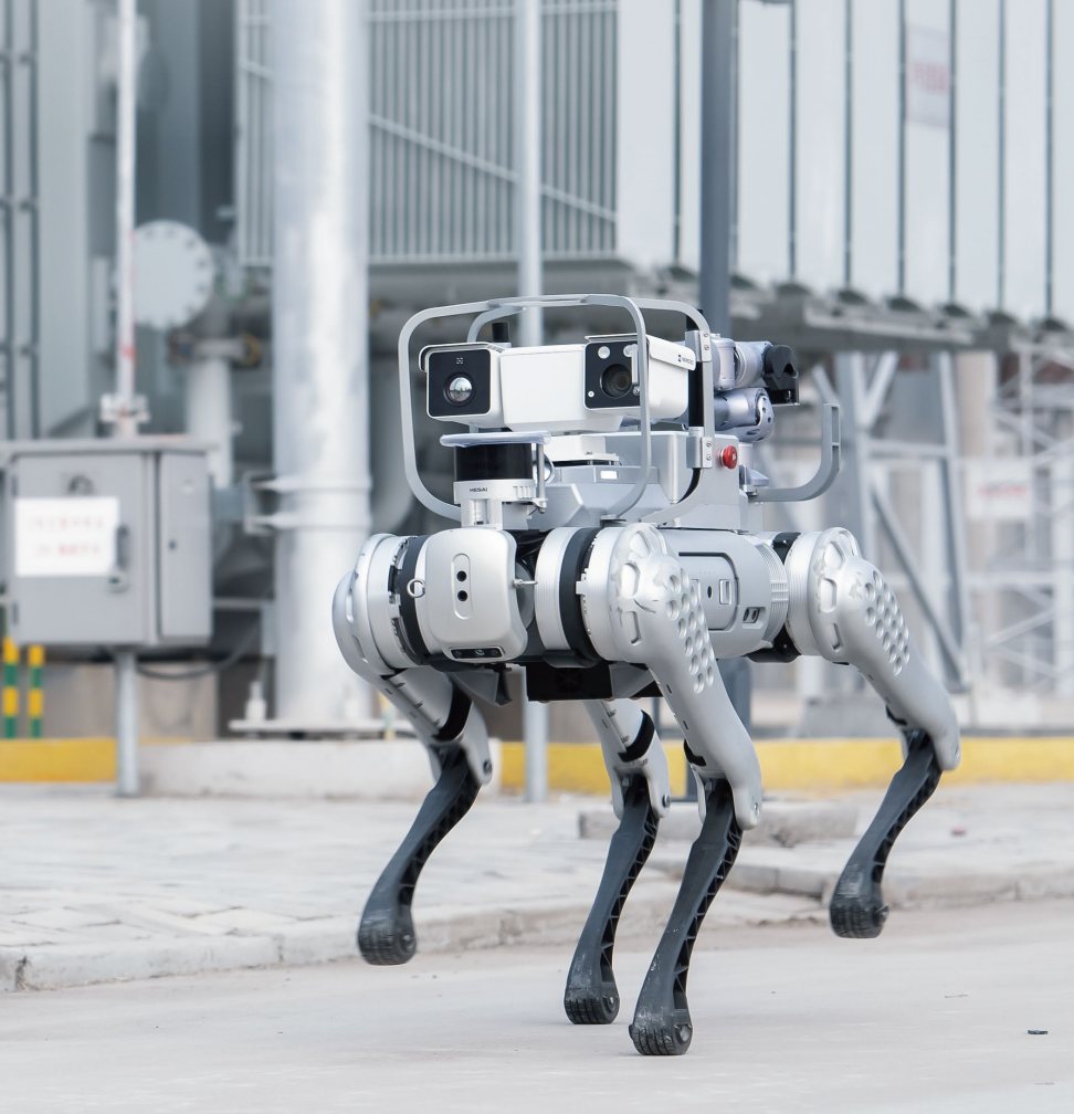
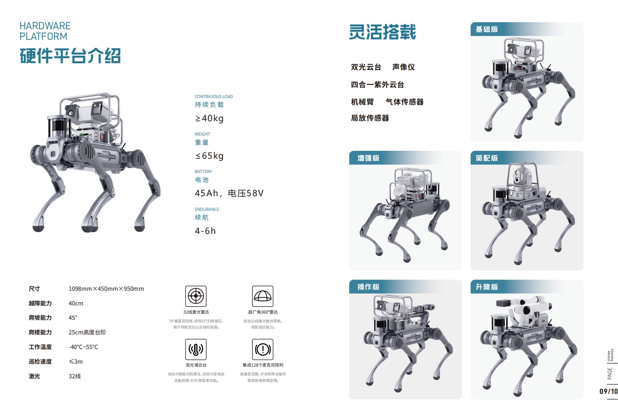
Quadruped robot with dual-spectrum gimbal, 3D LiDAR, 360° LiDAR and acoustic imager.
Recognition Algorithms
Video-image recognition auto-judges instrument and meter operating status.
Structured Big Data
Full collection + intelligent analysis forms structured multi-dimensional spatio-temporal data.
Deep Sensing & Warning
Deep perception and early warning of running equipment for emergency and decisions.
AI Recognition Capabilities
Video-image recognition auto-judges instrument status, reducing on-site manual patrol workload.
Hardware Platform
| Continuous Load | ≥ 40 kg |
|---|---|
| Weight | ≤ 65 kg |
| Battery | 45 Ah / 58 V |
| Endurance | 4 – 6 h |
| Dimensions | 1098 × 450 × 950 mm |
| Obstacle | 40 cm |
| Slope | 45° |
| Stairs | 25 cm step |
| Operating Temp. | -40 ℃ ~ 55 ℃ |
| Patrol Speed | ≤ 3 m/s |
| LiDAR | 32-line |
Flexible Payloads
Product Versions
32-line LiDAR
70° vertical FOV, 55° downward blind-zone scan for navigation and terrain detection.
Ultra-wide 360° Radar
Fused with 32-line LiDAR for strong terrain adaptability.
Dual-spectrum Gimbal
AI recognition for substation equipment detection and infrared thermometry.
128-mic Array
Partial-discharge monitoring of transformers and switchgear.
Application Scenarios
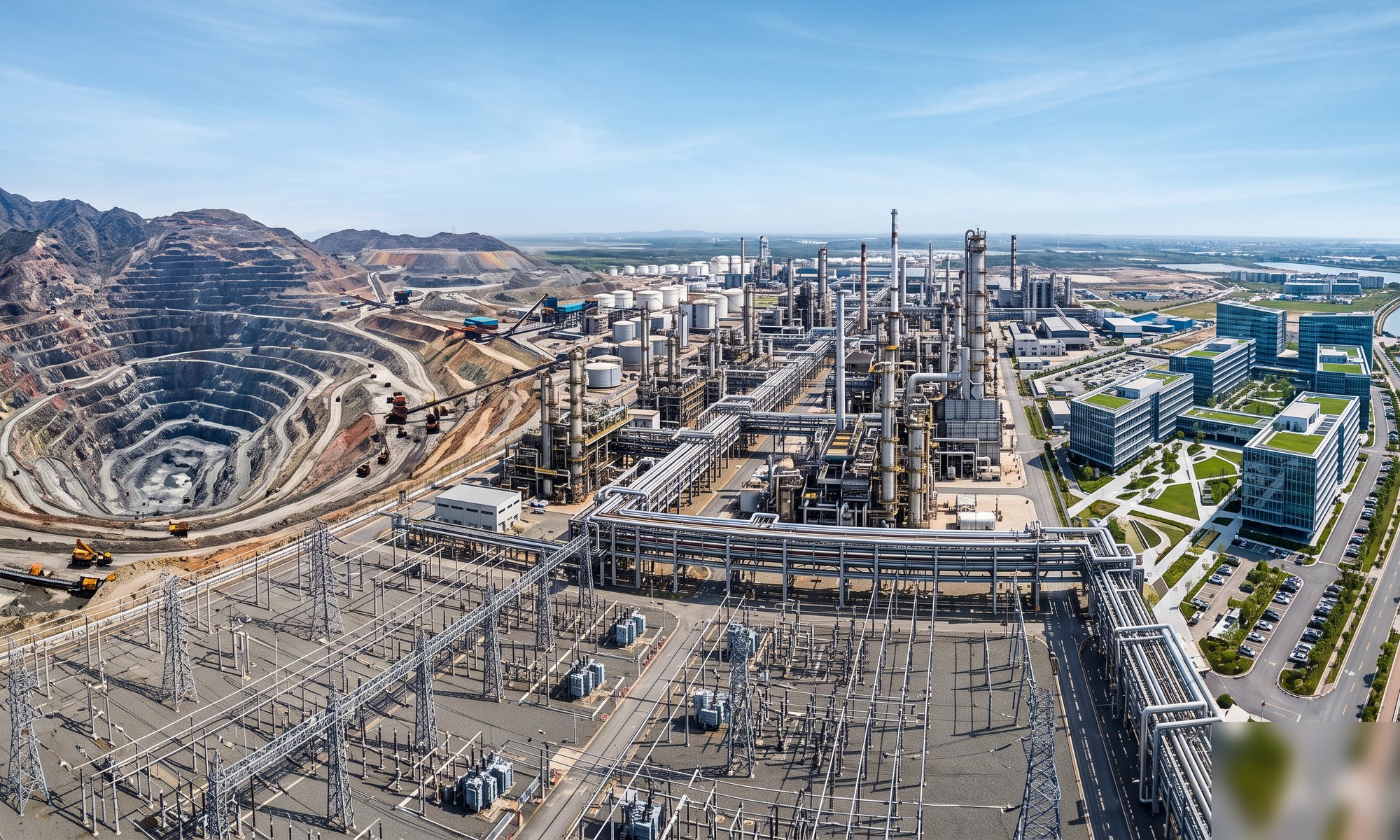
Discrete footholds let the quadruped robot adapt to stairs, steps, slopes and mountains, covering above- and below-ground environments; carrying various detectors to serve power, coal, mining, steel, railway and petrochemical industries.
Outdoor Scenarios
Indoor Scenarios
Real Deployments
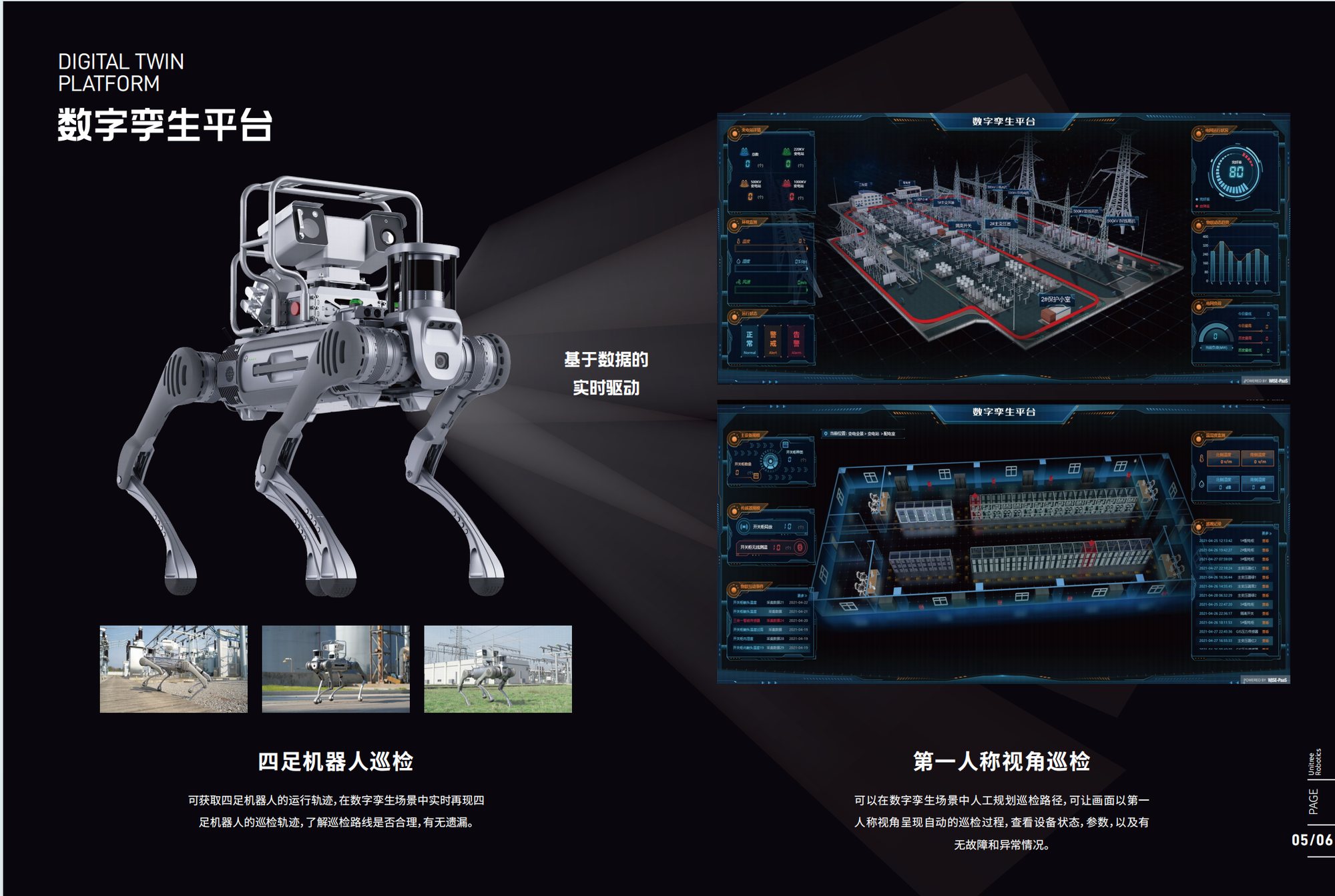
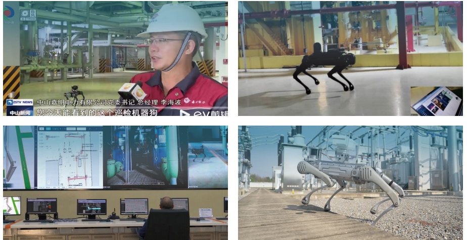
The system is running in multiple substations and industrial sites with media coverage; the control room monitors digital-twin views and live robot status remotely.
Ready to start your intelligent project?
Leave your requirements and our solution experts will respond within 24 hours.
Request a QuoteContact Us
Scan to add WeCom